Gas station nearby Krooning
Estonia
Gas station nearby Krooning
Krooning
9, Meistri tee, 76617, Tutermaa, EE Estonia
contacts phone
:
+372 666 0490
website:
krooning.ee
Latitude:
59.3293804
, Longitude:
24.4735688
larger map & directions
read more
nearest Gas station
2.853 km
Circle K Keila
Ülejõe
Gas station
read more
2.934 km
Alexela Keila station
Ülejõe tee 2
Gas station
read more
3.379 km
Neste Piiri
Piiri 14
Gas station
read more
4.319 km
Neste
Keila
Gas station
read more
4.906 km
Euro Oili Keila tankla
Haapsalu maantee 62
Gas station
read more
9.562 km
Neste
Pärnu maantee 453e, Tallinn
Gas station
Convenience store
Cafe
Car repair
Store
Restaurant
Food
Point of interest
Establishment
read more
15.377 km
Circle K
Sõpruse puiestee 200b, Tallinn
Gas station
read more
15.693 km
Circle K Nõmme
Männiku tee 2, Tallinn
Gas station
read more
15.786 km
Circle K
Pärnu maantee 236, Tallinn
Gas station
read more
15.932 km
Neste
Mustamäe tee 22, Tallinn
Gas station
read more
16.212 km
Neste
13417, Sõpruse puiestee 178, Tallinn
Gas station
read more
16.237 km
Olerex
Linnu tee 64, Tallinn
Gas station
read more
16.586 km
Circle K Järve Tankla
Pärnu maantee 180, Tallinn
Gas station
read more
16.996 km
Neste
Paldiski maantee 54, Tallinn
Gas station
read more
17.305 km
VAG auto
Mooni 30, Tallinn
Gas station
read more
17.478 km
Alexela Hipodroomi tankla
Paldiski maantee 48a, Tallinn
Gas station
read more
17.711 km
Circle K Endla
Endla 52, Tallinn
Gas station
read more
17.755 km
Kristiine Alexela Gas Station
Tallinn
Gas station
read more
17.84 km
Sõle CirkleK
Paldiski maantee 44, Tallinn
Gas station
read more
17.84 km
Circle K
Paldiski maantee 44, Tallinn
Gas station
read more
17.899 km
Circle K Kristiine
Endla 43, Tallinn
Gas station
read more
17.98 km
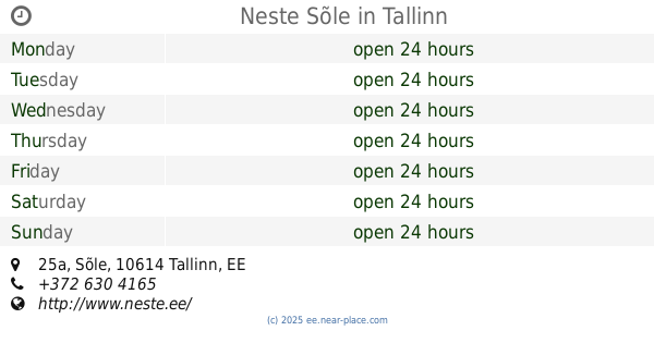
Neste Sõle
Sõle 25a, Tallinn
Gas station
read more
18.242 km
Olerex
Sõle 51b, Tallinn
Gas station
read more
18.275 km
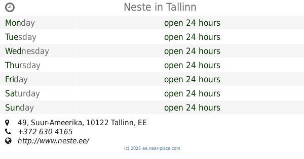
Neste tankla
Suur-Ameerika 49, Tallinn
Gas station
read more
18.276 km
Neste
Suur-Ameerika 49, Tallinn
Gas station
read more
📑
all categories
Accounting
Administrative area level 1
Administrative area level 2
Airport
Amusement park
Art gallery
Atm
Bakery
Bank
Bar
Beauty salon
Bicycle store
Book store
Bowling alley
Bus station
Cafe
Campground
Car dealer
Car rental
Car repair
Car wash
Casino
Cemetery
Church
City hall
Clothing store
Colloquial area
Convenience store
Country
Courthouse
Dentist
Department store
Doctor
Electrician
Electronics store
Embassy
Establishment
Finance
Fire station
Florist
Food
Funeral home
Furniture store
Gas station
General contractor
Grocery or supermarket
Gym
Hair care
Hardware store
Health
Home goods store
Hospital
Insurance agency
Jewelry store
Laundry
Lawyer
Library
Light rail station
Liquor store
Local government office
Locality
Locksmith
Lodging
Meal delivery
Meal takeaway
Mosque
Movie theater
Moving company
Museum
Natural feature
Neighborhood
Night club
Painter
Park
Parking
Pet store
Pharmacy
Physiotherapist
Place of worship
Plumber
Point of interest
Police
Post office
Premise
Real estate agency
Restaurant
Roofing contractor
Route
Rv park, camping
School
Shoe store
Shopping mall
Spa
Stadium
Storage
Store
Subpremise
Supermarket
Synagogue
Taxi stand
Train station
Transit station
Travel agency
University
Veterinary care
Zoo
sublocality level 1
↑